
Putting a Nation on the Map: The Construction of a Geographical Imaginary through the Project for a National Atlas of Ethiopia, 1962–1987
- Publication
- Comparativ
- Volume
- 32
- Issue
- 2
- Pages
- 264-288
Ethiopia
1962–1970Marie Huber examines the 1962 A Preliminary Atlas of Ethiopia as an early product of the state’s national atlas project. Its 34 black-and-white maps were presented as provisional responses to a shortage of information about Ethiopia. Huber finds that they relied heavily on foreign sources, theoretical assumptions, and extrapolation, with limited field-survey foundations. She criticizes the language map’s division of 11 languages into three families and interprets its use of “Negroid” in relation to racial distinctions asserted by Christian highland elites. Coarse hatching and patterning further emphasized apparently bounded language areas. Social mapping was limited to population density, while a world map centred on Addis Ababa positioned Ethiopia internationally. Huber reads these cartographic choices as part of the state’s effort to define national space and communicate a unified Ethiopian identity. The 1970 revision was unavailable to her and receives no substantive analysis.
View whole-article summary
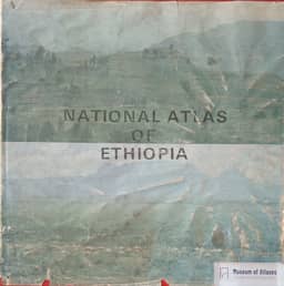
Marie Huber traces Ethiopia’s national atlas project from A Preliminary Atlas of Ethiopia (1962), through a 1970 revision and the 1981 Preliminary Edition, to the official National Atlas of Ethiopia, generally dated 1987 in the article. Her analysis uses the 1962, 1981 and final editions alongside geographic publications; the 1970 revision was unavailable. She connects atlas compilation to the state mapping institute founded in 1954, US-assisted training, geodetic surveying and aerial photography, subsequent UN support, and Canadian assistance for completing the official atlas. The publications expanded from 34 black-and-white maps in 1962 to 90 in 1981 and 75 colour thematic maps in the final atlas. Compilation shifted from foreign sources, theoretical extrapolation and limited surveys towards data supplied by Ethiopian institutions, including the population surveys begun in 1984. Huber examines increasingly differentiated language maps, expanded social and economic mapping, and historical maps that presented territorial conquest as reunification and omitted conflicts threatening national unity. She interprets these classifications and historical narratives as instruments of spatial appropriation and the construction of a Greater Ethiopian identity under both imperial and socialist governments. Maps positioning Ethiopia internationally also register a shift from Western and UN connections towards an African regional orientation. Huber treats the atlases as sources for contested unity policies and ethnic conflicts, while identifying reception, classroom use and practical applications in planning as subjects requiring further research.
Related Atlases
Comments
Loading...
0/2000