
Development Directions for the National Atlas of the Republic of Korea through a Comparative Analysis of National Atlases
국가지도집의 비교 분석을 통한 대한민국 국가지도집의 발전 방향
- Publication
- 대한지리학회지
- Volume
- 52
- Issue
- 4
- Pages
- 495–510
South Korea · Version 2
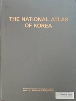
2007–2009In their account of Korea's national-atlas development, Jeong Jae-joon and Hwang Chul Sue describe the 2007 National Atlas of Korea as a project commissioned by the National Geographic Information Institute and undertaken by the Korean Geographical Society in 2006–2007. They connect its initiation to the 2005 Dokdo dispute and the government's aim of supplying official information on territory, boundaries and standardized geographical names. The 297-page atlas appeared in Korean and English, with 1,500 copies of each, and contained about 250 thematic and general maps covering five major subject areas and changes mainly during 1990–2005. About 70 scholars and more than 50 government ministries and agencies participated. The authors describe GIS-based thematic-map production, explanatory texts and an accompanying CD containing statistical spreadsheets and an e-book. They judge its editorial structure and mapping techniques to follow international standards, while noting that the single-volume format restricted content, the large size reduced portability and the print run limited distribution. They explain that selected content was re-edited into a smaller English edition in 2009, with 20,000 copies distributed worldwide.
View whole-article summary
The South Korean government published national atlases twice, in 2007 and from 2014 to 2016. The national atlas published between 2014 and 2016 is regarded as more advanced than the 2007 edition in terms of both format and content. However, it still leaves room for improvement in the quality of maps, infographics, and descriptive text compared to models from advanced countries. Furthermore, given the rapidly increasing demand for spatial information in the 21st century and the widespread use of computer technology across society, the national atlas also requires complementary work on its digital systems. Against this background, this paper aims to propose directions for the development of future national atlases of South Korea. To this end, the production and development processes of national atlases were analyzed by dividing them into domestic and international cases, with international cases further examined by separating print and digital formats. Based on this analysis, development strategies for the South Korean national atlas were proposed from four perspectives: the advancement of print-format national atlases, the transition to digital national atlases adopting an atlas information system, the establishment of a system for continuous updates to the national atlas, and institutional mechanisms for producing the national atlas.
Related Atlases

Comments
Loading...
0/2000