
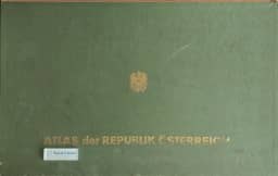
The atlas of the Republic of Austria
Der Atlas der Republik Österreich
- Publication
- Berichte zur Landesforschung und Landesplanung
- Volume
- 6
- Issue
- 1
- Pages
- 12-18
Austria · Version 1
1980–1986Hans Bobek describes the aims, organization and early production of the Atlas of the Republic of Austria, compiled by the Austrian Academy of Sciences’ Commission for Spatial Research under his direction. Its first installment appeared in 1961; five further installments containing another 100 map plates were planned over the following five to six years. Bobek argues that national atlases make regional relationships visible where administrative statistics and departmental responsibilities obscure them. He defines this atlas as a “cartographic regional geography” covering Austria’s natural environment, population, settlements, economy, transport, administration and culture. Its thematic sections are designed to proceed from individual elements to spatial syntheses: terrain types and natural regions, settlement landscapes, agricultural production zones, industrial areas, transport networks and tourism regions. The final section is intended to combine these into economic landscapes, central-place systems and socioeconomic municipal types, alongside commuting, electoral patterns, settlement decline and development needs. Comparing this approach with planning atlases, especially the Planungsatlas Lavanttal, Bobek links their methodological similarities to recommendations he made in a June 1953 assessment. He distinguishes their purposes: the Austrian atlas supplies broad geographical information and a framework for regional planning, while planning atlases organize evidence around development programs. He also treats spatial research as an applied, interdisciplinary study of inhabited and utilized space. Maps carry the principal explanatory burden; accompanying texts and tables are envisaged for later. The main scale of 1:1,000,000 permits representation of approximately 4,000 municipalities. The editors seek precise locations and boundaries, geographical context for each theme, complementary analytical and synthetic maps, and extensions into neighboring territories where useful. Specialists and public scientific institutions prepare designs, which the editorial staff revises and coordinates. A nationwide municipal survey supplied evidence on central places; a Geological Survey inquiry into groundwater, springs and water supply was planned. Freytag-Berndt and Artaria handle technical production, printing and publication, supported by Academy and ministerial subsidies. Bobek presents the atlas as an information resource for research, government and the public, and as a means for citizens to understand their country’s spatial conditions and possibilities.
Comments
Loading...
0/2000