
Review of books: Atlas do Brasil; Atlas of Israel
- Publication
- Scottish Geographical Magazine
- Volume
- 79
- Issue
- 1
- Pages
- 60
Brazil
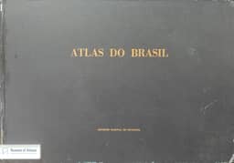
1959J. S. Keates reviews the 1959 Atlas do Brasil as a geographical sketch, relating its limited detail to Brazil’s vast extent, superficially known areas and lack of large-scale topographic coverage. He describes three parts covering regional geography, the country as a whole, and individual states and territories. Regional maps at approximately 1:3 million to 1:8 million cover relief, climate, vegetation, population, economic production and transport. Keates identifies the physiographic diagrams used to portray relief as the atlas’s only novel cartographic method. He criticizes the drawing and reproduction standards but finds most maps simple and legible, judging the volume a courageous attempt at a difficult task. All maps have explanatory text, and the volume is sturdily bound.
View whole-article summary
This article compares the national atlases of Brazil and Israel, illustrating the diverse challenges cartographers face when dealing with different national units. The Atlas of Brazil serves as a general geographical sketch of a vast, underdeveloped region, employing basic cartographic methods including physiographic diagrams; despite modest drafting and reproduction standards, its maps are simple and legible, representing a courageous attempt at a formidable task. In contrast, the Atlas of Israel offers a detailed examination of historical and contemporary distributions within the modern state's territory, covering sections on cartography, physical geography, history, demography, economics, and education. Its cartographic techniques follow standard national atlas practices, with high-quality drafting and reproduction, ranking it among the best existing national atlases. Together, these two works highlight the variety of approaches in data presentation and cartographic methodology.
Related Atlases

Comments
Loading...
0/2000