
National atlases: A summary
- Publication
- Geographical Review
- Volume
- 47
- Issue
- 4
- Pages
- 570-578
Algeria · Version 1
1924–1935In a survey of national atlases, Yonge records that the French government in Algeria began the ambitious Atlas d'Algérie et de Tunisie in 1923, jointly authored by Augustin Bernard and R. de Flotte de Roquevaire. Sixteen parts were planned, but only nine had appeared by 1933, treating geology, relief, climatology, vegetation, population, colonization and agriculture, each with explanatory text. The general scale is 1:1,500,000, with smaller scales for special maps. Yonge judges the atlas well planned and well executed and regrets that it was never completed.
View whole-article summary
This article provides a comprehensive review of national atlases published worldwide up to the time of writing. It notes that since the Geographical Review first coined the term 'Age of National Atlases' in 1940, the surge of nationalism after World War II has greatly accelerated the production and scope of such atlases. The author surveys 26 published national atlases and 3 in preparation. The article first emphasizes that a national atlas aims to portray all aspects of a country—physical, economic, and social—and highlights a welcome trend: the inclusion of map titles, legends, and text summaries in English or French for atlases published in less familiar languages. The review is then organized by region. For Europe, it details atlases from Austria (Atlas von Niederösterreich), Belgium (Atlas de Belgique), France (revised Atlas de France), and Germany (Deutscher Planungsatlas, specifically Atlas von Berlin), among others, discussing their institutional backing, content structure, scales, cartographic techniques, and unique features, such as Berlin's depiction of wartime damage and postwar development, and Belgium's detailed demographic and agricultural maps. Atlases from Czechoslovakia, Denmark, Finland, Italy, and Norway are also mentioned. For Africa, the planned Atlas du Maroc is described. For Oceania, the Atlas of Australian Resources is reviewed, highlighting its origin in post-war resource assessment, its effective use of a large scale, and its focus on water resources and population distribution. For North America, the article reports on the progress of a Canadian national atlas and the initiation of the National Atlas of the United States, a collaborative federal effort to compile standardized thematic maps from various government agencies. The article concludes that these national atlases represent significant achievements in geographic and cartographic scholarship, serving as invaluable resources for students, planners, and businesses.
Related Atlases
Atlas of Algeria and Tunisia. Fascicle II: Hypsometry
Algeria · 1924
Atlas of Algeria and Tunisia. Fascicle III: Climatology: Temperatures
Algeria · 1924
Atlas of Algeria and Tunisia. Fascicle VI: Climatology: Mean Monthly Rainfall
Algeria · 1927
Atlas of Algeria and Tunisia. Fascicle IX: Demography
Algeria · 1929
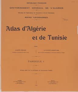
Atlas of Algeria and Tunisia. Fascicle I: Geology
Algeria · 1925
Atlas of Algeria and Tunisia. Fascicle V: Climatology: Mean Annual Rainfall
Algeria · 1926
Atlas of Algeria and Tunisia. Fascicle VII: Climatology
Algeria · 1928




Comments
Loading...
0/2000