
Rwanda and Burundi: Based on two recent atlases
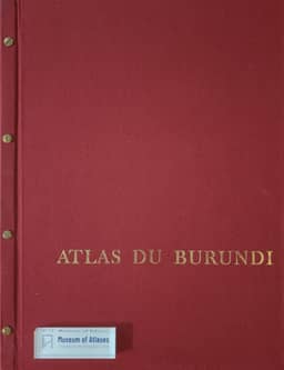
Le Rwanda et le Burundi: d'après deux récents atlas
- Publication
- Les Cahiers d'Outre-Mer
- Volume
- 35
- Issue
- 140
- Pages
- 379-387
Rwanda · Version 1
1981In his comparative review, Louis Papy discusses Atlas du Rwanda, directed by Christian Prioul and Pierre Sirven and produced by the French Ministry of Cooperation for the National University of Rwanda. He praises its colour plates, substantial explanatory notes and extensive bibliography. His account covers physical geography, history, population, health, agriculture and urban development. He commends the geomorphological mapping for its grounding in field knowledge and highlights Prioul’s climatic regionalization, which shows diversity that a simple scheme of altitudinal zones would obscure; evapotranspiration and mountain climates remain insufficiently understood. The soil and vegetation plates address agricultural potential, erosion risks and the effects of clearing. Papy gives particular attention to the atlas’s account of changing rural land use: cultivation expands into pasture, steep slopes and drained valley marshes, while traditional erosion-control practices face pressures from intensified cultivation, livestock and deforestation. He also values the health plates for relating disease distribution to physical environments and ways of life. Historical discussion includes Prioul’s adoption, in its essentials, of an interpretation in which incoming Tutsi pastoralists imposed their rule on Hutu cultivators; Papy notes that the Burundi atlas’s historians contest this account. The review also describes Sirven’s treatment of Kigali’s growth as the capital and Butare’s continuing educational and research functions. Papy’s overall assessment of the atlas’s cartographic execution and explanatory content is strongly favourable.
View whole-article summary
This article provides an in-depth geographical and human analysis of Rwanda and Burundi, two small Central African countries, based on two recently published high-quality atlases. Both atlases were funded by the French Ministry of Cooperation and produced by geography teams from the National University of Rwanda and the University of Burundi, respectively. The article begins by highlighting the striking similarities between the two countries in geography and history: both are landlocked nations situated on high plateaus nourished by tropical rains, sharing a past of kingdom-building, German and Belgian colonization, and gaining independence in 1962 and 1963, respectively. They are densely populated, practice intensive agriculture, and are home to the same three ethnic groups—Hutu, Tutsi, and Twa—with stable state structures and unified languages. The core of the article dissects the physical geography of both nations. By interpreting the atlases' content, it systematically describes the geomorphological units from west to east, including the East African Rift occupied by Lake Kivu and Lake Tanganyika, volcanic mountain ranges, the north-south oriented Congo-Nile Ridge, the typical 'land of a thousand hills,' and the eastern plains bordering Tanzania. Regarding climate, the article emphasizes altitude as the dominant factor near the equator, resulting in pleasant temperatures and abundant rainfall, and it delineates various bioclimatic regions. The text also addresses environmental issues under population pressure, particularly soil erosion and deforestation, as well as efforts to reclaim marshy valleys through drainage and irrigation. Finally, it focuses on urbanization, noting the still-low rates and analyzing the rapid growth and central roles of the capitals, Kigali and Bujumbura, while mentioning other, less developed towns and the limited tourism potential. The author concludes that these atlases, with their detailed information and excellent colored plates, make a significant contribution to understanding the regional diversity, environmental challenges, and development prospects of Rwanda and Burundi.
Related Atlases

Comments
Loading...
0/2000