
Thoughts concerning the "Atlas of Turkey"
- Publication
- Türk Coğrafya Dergisi
- Volume
- 22-23
- Pages
- 241-244
Türkiye · Version 1
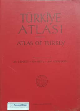
1961W. Hütteroth reviews Türkiye Atlası (Atlas of Turkey), prepared by Ali Tanoğlu, Sırrı Erinç and Erol Tümertekin and published in 1961 through Istanbul University's Geographical Institute. He regards it, with qualifications, as Turkey's first national atlas. Its 87 colored maps with Turkish and English legends bring together dispersed regional-geographical material, largely reusing previously published maps by the editors; this produces uneven organization, while the original studies provide fuller explanations. Climate occupies 43 maps, but sparse station coverage, especially in mountains, requires interpolation. Hütteroth calls for a complementary morphological map, fuller vegetation coverage and district-level reporting instead of broad provincial units. He praises Tanoğlu's point-and-ball population map while noting its reliance on the 1935 census, and welcomes the land-use map while questioning its limited cropland coverage in Central Anatolia. Printing delays from a planned 1954 publication left statistics ending in 1952–53 and town-size symbols outdated. For a future edition he proposes newer thematic maps and larger-scale regional examples, extending the atlas's special maps of surrounding seas and straits. Despite these limitations, he judges the atlas a substantial achievement under Turkey's data and research constraints and a useful resource for regional studies.
Related Atlases
Comments
Loading...
0/2000