
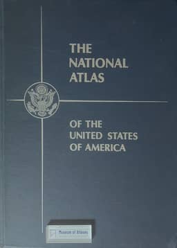
The National Atlas of the United States of America
- Publication
- The Cartographer
- Volume
- 2
- Issue
- 1
- Pages
- 35-36
United States · Version 2
1970Arch C. Gerlach describes the preparation and planned contents of The National Atlas of the United States of America. He traces its antecedents through the American Geographical Society’s 1952 prototype and approximately 80 loose-leaf map sheets produced under a National Academy of Sciences committee in 1955–1961. The need for more orderly contents, consistent quality and centralized distribution led to transfer of responsibility to the U.S. Geological Survey. Established in fiscal 1963, the project surveyed prospective users, reviewed existing atlases and recommendations, and prepared contents and standard plotting bases; funding cuts suspended it in fiscal 1964 before its reactivation in 1965. Federal agencies and other contributors would supply material, while the Survey would handle scribing, reproduction and distribution. The planned volume exceeded 400 pages, including 45 pages of sectional reference maps and about 300 pages of thematic maps covering physical geography, history, economic and social conditions, administrative divisions and mapping coverage. Gerlach also outlines a detailed index, source references, adhesive binding informed by user preferences, separate map sales and continuing revision. Bound-volume completion was targeted for late 1967.
View whole-article summary
When the National Atlas was completed in loose-leaf form in 1961, the National Atlas Committee, established by the National Academy of Sciences, recommended that the Geological Survey of the United States be entrusted with the task of publishing a new atlas. A group of technicians began work in 1963 by preparing map layouts and base maps, and established contacts with federal agencies, professional associations, universities, commercial cartography companies, and specialists. Although many organizations and numerous individuals are to contribute to the preparation of the new atlas, the Geological Survey of the United States alone will be responsible for its publication, with a view to ensuring uniformity of style and format. The Atlas will comprise approximately 400 plates, of which 300 will contain social maps at scales of 1:7,500,000, 1:17,000,000, and 1:34,000,000, covering physical features, history, economic and social conditions, educational achievements, and administrative divisions. It is anticipated that this atlas will be completed in 1967.
Related Atlases
Comments
Loading...
0/2000