
The atlas of Ireland
- Publication
- Irish Geography
- Volume
- 12
- Issue
- 1
- Pages
- 1–9
Ireland · Version 1
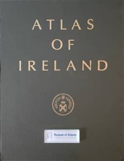
1979J. P. Haughton recounts the seven-year compilation of the Atlas of Ireland under the Royal Irish Academy. Proposals developed in 1969 around the forthcoming 1971 censuses; an editorial board was established in 1971, and a cartographic working party took a central production role in 1974. Government support and bank underwriting enabled production to proceed, with costs eventually exceeding £100,000. Intended as a bound thematic atlas covering the whole island and drawing chiefly on existing data, it developed through repeated revisions into approximately 220 maps in fourteen sections within a 96-page map allocation. Contributors supplied drafts, which the working party edited, submitted to independent referees and documented through standardised drawing specifications. George Philip and Son prepared and printed the six-colour maps; text printing and binding were undertaken in Ireland. Haughton describes decisions on scales, base maps, symbols, lettering and colour, alongside difficulties obtaining adequate statistics and maintaining consistent presentation. Plastic proofs were checked for factual content and paper proofs for colour and registration; the last plastic proof arrived in May 1979. Map notes explained sources, definitions, selection criteria and data limitations without analysing distributions. Haughton concludes that earlier contributor guidelines and professional cartographic involvement would have helped, while acknowledging the flexibility afforded by the evolving compilation process.
View whole-article summary
This is an informal account of the creation of a thematic atlas of Ireland over a period of seven years. The first part relates to the setting up of an organisation for the project under the auspices of the Royal Irish Academy and touches also on some of the financial implications. The second part explains how the contents of the atlas were selected and the maps compiled. Various problems including those relating to the choice of data, the scale and format of the maps, the use of colour and the correction of the proofs, are also discussed. The need for a thematic atlas of Ireland was recognised and discussed in academic circles as long ago as the 1940s, but the possibility of producing such an atlas was limited by the small number of professional geographers in the country and by a paucity of financial resources. However, following an expansion of Irish university departments of geography in the sixties, and affiliation to the International Geographical Union through a national committee of geography set up under the auspices of the Royal Irish Academy in 1963, there came into being a representative group of geographers capable of giving sustained consideration and support to such a project. In 1969, following informal consultation between geographers, outline proposals for an atlas which would be based on the data arising from the impending censuses of population of April 1971 were considered by the National Committee and were subsequently accepted by the Council of the Academy. In May 1970 the Academy sought and was promised financial support from the Department of Education in Dublin for the preliminary compilation and drawing of the atlas maps and as a result £8,000 was made available for this purpose over the following three years. An atlas committee, set up by the Academy, met for the first time on 16 November 1971. It was composed of the professors of geography from Queen's University Belfast, University College Dublin, and Dublin University, together with representatives from the Ordnance Survey of Ireland, the Geological Survey of Ireland and An Foras Taluntais,³ and the secretary of the National Committee. Subsequently the Department of Education was also represented. At its first meeting the committee renamed itself the Editorial Board of the Atlas of Ireland and one of its first tasks was to appoint Mrs Mary O'Regan as coordinator for the project. The Board also had some discussion on suitable scales, base maps and the general organisation of the work. The proposed maps had been listed tentatively under eight subject heads and it was suggested that committees should be set up for each of these groups of related maps. In the event these committees were found to be unnecessary so, instead, section coordinators, acting on a voluntary basis, were appointed, each one assuming responsibility for producing draft maps in his section under the general supervision of the Editorial Board. Initially these sections were geology and geophysics, physiography and hydrology, soils, climate, vegetation, population, settlement, agriculture and fisheries. Others were added later. As the work of compilation progressed it was realised that there were many questions of method, drafting and format which were of too specific a nature for detailed consideration at meetings of the Editorial Board so, after several unsuccessful attempts, the Board at its meeting on 7 March 1974 set up a small Dublin-based cartographic working party.
Related Atlases
Comments
Loading...
0/2000