
The Atlas of Australian Resources
- Publication
- Australian Geographer
- Volume
- 6
- Issue
- 2
- Pages
- 6–14
Australia · Version 1
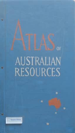
1960–1977Editor Konrad Frenzel describes the conception, planned contents, compilation, and production of the Atlas of Australian Resources and its accompanying commentary booklets. He places the project within the expansion of thematic resource atlases after the First World War, as government sponsorship and planning needs broadened their coverage to social conditions, services, and development prospects. The Australian project originated in the Department of Post-War Reconstruction in late 1948 as a collection for official use. Existing state publications and accumulated research provided valuable material, but a coordinated national atlas required consistent scales and representation. A section of the Department of National Development began full-time preparation in 1951. The planned 50 maps cover physical conditions and resources, economic and social activity, and potential development; the subjects of the final ten development maps remained to be decided. Most sheets use a scale of 1:6,000,000 and a simplified National Mapping Office base, with Tasmania in its correct geographical position. Each map has an 8–16-page commentary booklet explaining its background and supplying information unsuitable for cartographic display. Maps and commentaries are sold together, with sheets designed for collection in an atlas cover or storage in a box. Frenzel explains how geographers select and classify information, consult agencies and specialists, and prepare coded compilations for draftsmen. Production uses transparent Astralon sheets, photographically reduced symbols and lettering, coloured proofs checked by contributors, and offset printing averaging seven to nine colours. The atlas was still in preparation: one map had been printed and five were with the printer. The first issue comprises Mineral Deposits, Rainfall, Temperature, Underground Water, and Soils. Frenzel describes mineral symbols differentiated by group, economic importance, and deposit size; circular arrangements of monthly climate maps that preserve continuity between December and January; soil colours related to moisture zones and broadly to fertility; and groundwater symbols showing availability, salinity, and flowing bores. He acknowledges that free groundwater cannot be adequately mapped at this scale. Government and research specialists also supply the commentaries. Frenzel stresses collective preparation and intends the atlas to support planning, education, public knowledge, and overseas understanding of Australia.
Comments
Loading...
0/2000