
On some new atlases
Su alcuni nuovi atlanti
- Publication
- Bollettino della Società Geografica Italiana
- Volume
- 1
- Issue
- 9–10
- Pages
- 471–497
Canada · Version 2
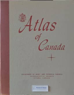
1957–1959Riccardo Riccardi reviews the Atlas of Canada, issued in English and French, as a work of 110 plates containing 430 maps, produced through nearly a decade of research and compilation by scientists and federal officials. He notes that its consistent use of the Lambert conformal conic projection and scales related to 1:10,000,000 facilitates comparison. He particularly praises the climatic coverage, the 1951 population maps, and maps of fisheries, agricultural regions, manufacturing and transport. He finds the maps of population change and Indigenous population distribution too generalized. He also notes the absence of maps of trade and finance and of regional economic syntheses, and wishes that historical comparisons extended beyond population distribution to economic activities. Despite these reservations, he judges the atlas one of the best national atlases.
View whole-article summary
This article critically reviews fifteen geographical atlases published in the 1950s, assessing their scope, cartographic methods, thematic content, technical execution, accuracy, and usefulness for reference or education. The works comprise five general reference atlases—the fifth edition of Luigi Visintin’s Grande Atlante Geografico, the French Atlas Général Larousse, and the German Columbus Weltatlas, Grosser Herder Atlas, and Knaurs Weltatlas—together with a British economic atlas of the Middle East and North Africa, a concise Italian polar atlas, three national atlases devoted respectively to Canada, Portugal, and Colombia, an atlas of the Arab world and Middle East, and four advanced school atlases: the revised Diercke Weltatlas, J. E. Williams’s World Atlas, the Nederlandse Wereldatlas, and the Oxford Australian Atlas. For each publication, the author identifies innovations and compares them with earlier editions or related works. Particular attention is paid to map scales, relief representation, projections, color schemes, geographical grids, place-name consistency, statistical dating, urban plans, indexes, and the selection and updating of physical, political, historical, ethnolinguistic, and economic information. The new Grande Atlante Geografico is praised for its greatly expanded economic cartography, larger-scale maps, and more effective rendering of relief, but criticized for removing the valuable historical section, reducing explanatory texts, and retaining inconsistent nomenclature and outdated details. The Atlas Général Larousse is strongest in its extensive thematic, historical, and economic maps, while its physical-political maps suffer from uneven scales, harsh colors, weak relief depiction, factual errors, and obsolete information. Similar scrutiny is applied throughout to the balance between visual clarity and informational density: overloaded symbols, poorly differentiated hypsometric tints, crude shading, arbitrary feature selection, and inaccurate economic distributions frequently diminish otherwise ambitious works. National and regional specialization often produces the best results. The Nederlandse Wereldatlas, for example, contains an exceptionally original, meticulous, and technically accomplished treatment of the Netherlands, including large-scale regional maps and detailed representations of geology, climate, soils, population, land use, resources, cities, and ports; its coverage of Belgium, Luxembourg, and Dutch overseas territories is also valuable. Conversely, its economic map of Italy requires substantial revision. The Oxford Australian Atlas provides useful thematic maps of Australian climate, hydrology, vegetation, population, soils, agriculture, and mining, partly derived from the Atlas of Australian Resources, but its general maps inadequately portray landforms because of flat hypsometric coloring and coarse, sometimes misleading shading. Overall, the review presents atlases as complex scholarly instruments whose quality depends not merely on abundance of material, but on current and verifiable data, coherent editorial standards, appropriate scale and projection, accurate nomenclature, legible symbolism, and technically convincing depiction of terrain. The article combines recognition of major advances in thematic and economic cartography with detailed recommendations for correction and improvement in future editions.
Related Atlases

Comments
Loading...
0/2000