
Reports: New atlases of individual countries
Sprawozdania: Nowe atlasy poszczególnych krajów
- Publication
- Przegląd Geograficzny
- Volume
- 17
- Pages
- 101-110
France · Version 1
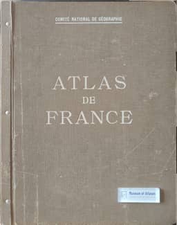
1945–1959Stanisław Pietkiewicz reviews Atlas de France while it was still being published: 56 of the 84 plates planned in his account had appeared. He describes its coordination by the French National Committee of Geography, with contributions from universities and public agencies, and surveys its physical, agricultural, industrial, transport and population mapping. Particular attention goes to E. de Martonne’s four-sheet geomorphological map, then in press, which combined a simplified elevation background with six colours distinguishing landform groups. Pietkiewicz also highlights the aridity-index maps, hydrological mapping and classification of farm types as new approaches. He regards the atlas’s chief value as its synthesis of France according to the concepts of the French geographical school, while noting that geological and geobotanical maps and part of the economic section were still missing. Brief notes on the backs of the maps explain their purposes and sources; there is no separate explanatory text.
View whole-article summary
This article reviews the development of comprehensive regional atlases and provides a detailed assessment of major national atlases published in Europe during the first half of the 20th century. The author begins by noting that regional atlases serve not only as visual complements to statistical publications but also as scientific syntheses of knowledge about a country. Citing the 1910 and 1925 editions of the "Atlas de Finlande" as exemplary, the article traces the historical lineage of such publications, mentioning early examples from Germany, Austria-Hungary, and Russia. The core of the article focuses on five significant atlases published between the world wars: the "Atlas of Industry of the USSR," the "Atlas de France," the "Atlas of the Czechoslovak Republic," the "Atlas des deutschen Lebensraumes," and the "Atlante fisico-economico d'Italia." The "Atlas de France," coordinated by the French National Geographic Committee, was planned to include 84 large plates covering topography, climate, hydrology, biogeography, agriculture, mining, industry, transportation, population, and politics. Its innovative cartographic concepts, such as aridity index maps and morphological maps, reflect the advanced ideas of the French geographical school. The "Atlas of the Czechoslovak Republic," published by the Czech Academy of Sciences between 1930 and 1935, is praised for its aesthetic layout, rich colors, and print quality, comprising 55 large plates on physical geography, geology, climate, biology, population, economy, and history. The article also reviews the "Atlas of Ukraine and Adjoining Countries," edited by Kubijovych, which covers natural, demographic, economic, historical, and cultural topics, though some maps exhibit political bias. Additionally, the author briefly discusses two smaller atlases: the "Atlas of the Free City of Danzig," focusing on human geography, and "Poland and Its Economy," published by the Königsberg Institute, which, despite its modest appearance, offers substantial content. The article concludes by summarizing the cartographic methods, organizational structures, and scientific merits of these atlases, noting their respective strengths and weaknesses.
Related Atlases
Comments
Loading...
0/2000