
Reviews. Spain in maps. A geographical synthesis
Reseñas. España en mapas. Una síntesis geográfica
- Publication
- Estudios Geográficos
- Volume
- 80
- Issue
- 287
- Pages
- e028
Spain · Version 4
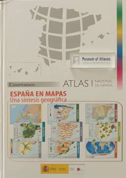
2019–2025This review examines España en mapas. Una síntesis geográfica, published in 2018 by Spain’s Instituto Geográfico Nacional and Centro Nacional de Información Geográfica as the first product of the twenty-first-century National Atlas of Spain project. It outlines the atlas’s publication history and collaborative framework, including the ANEXXI network of 34 universities and four research institutions. The 620-page volume contains approximately 1,250 graphics, including 800 maps, covering the natural environment, population, economic activities, infrastructure and services, landscapes, and territorial structures, alongside historical cartography and Spain’s global geographical context. The reviewer praises its informational and design quality and identifies uses in teaching, research, territorial management, and public geographical learning. The review also describes access through print purchase, free PDFs, and downloadable maps and associated data.
Comments
Loading...
0/2000