
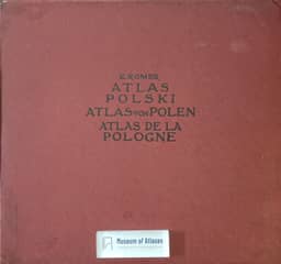
Presentation of the “Geographical and statistical atlas of Poland”
Prezentacja „Atlasu geograficzno-statystycznego Polski”
- Publication
- Sprawozdania z Czynności i Posiedzeń Akademii Umiejętności w Krakowie
- Volume
- 20
- Issue
- 9
- Pages
- 20-27
Poland · Version 1
1916–1921This presentation describes Eugeniusz Romer’s Geographical-Statistical Atlas of Poland, its compilation and its publication in progress. Romer sought to document traces of Poland’s former unity, the effects of partition and the strength a united Poland could represent. Franciszek Stefczyk secured funding from Polish savings and loan societies, enabling organized compilation within several months. The completed compilation comprised 65 maps on 32 sheets with accompanying explanatory texts; wartime conditions led to a three-fascicle publication plan. Its coverage extended across Poland’s 1772 territory and additional areas with substantial Polish populations, addressing physical geography, history, population, religion, education, landholding, agriculture, industry, transport and credit cooperatives. Much of the account concerns assembling sources and reconciling incompatible statistics from the three partitioning states. Libraries, private collections and specialist collaborators supplied material, generally mapped by county, although uniform data remained unavailable for some subjects. Industrial mapping required converting production values into worker counts and estimating total industrial employment from large-industry figures, using conversion relationships derived partly from 26 Austrian chambers of commerce and industry. Romer acknowledged differences in census dates and estimated errors of about 10%, potentially reaching 25%. Interpolation placed statistical values at county towns and connected equal values with lines called isarithms; he explained its departures from strict interpolation and argued that it conveyed geographical relationships obscured by administrative boundaries. The account also describes the first fascicle’s historical, demographic, religious and cultural maps; the second was already at press, while the third was planned to contain the remaining material. Explanatory texts documented sources, dates, methods and map reading for specialist and wider audiences. Romer proposed using the atlas to examine partition-era influences, assess wartime losses indirectly and develop a future synthesis of the routes of material and intellectual culture across Polish lands.
Comments
Loading...
0/2000