
Presentation of the atlas of Algeria and Tunisia
Présentation de l'Atlas d'Algérie et de Tunisie
- Publication
- Comptes rendus du Congrès international de géographie, Paris, 1931
- Volume
- Tome I
- Pages
- 350-354
Algeria · Version 1
1924–1935R. de Flotte de Roquevaire presents the published fascicles and continuing compilation of the Atlas of Algeria and Tunisia, issued by Algeria’s Government General with Tunisian financial support. Conceived as an inventory of existing knowledge to support land use and administration, the project developed through support from Governor General Jonnart and his successors, scholars, and public services. It comprises seven sections: geology, hypsometry, climatology, vegetation, demography, economic geography, and administrative geography. The author reports that the first four are complete, demography nearly complete, and the last two begun, with completion expected in 1932. He describes lightly generalized army-map contours reduced photographically in stages to 1:1,500,000; rainfall mapping based on 377 stations for 1876–1920; René Maire’s botanical mapping; Augustin Bernard’s rural-housing map; and population maps using the 1926 census and earlier counts. Economic and administrative coverage includes a published vineyard map and planned production, infrastructure, administrative-boundary, colonization, and historical-administration maps. Illustrated explanatory notices accompany the maps or sections. The author argues that common scales facilitate comparison, treats rainfall maps as key to interpreting agricultural and population patterns, and characterizes the atlas’s locally organized production as scientific and industrial decentralization.
Related Atlases
Atlas of Algeria and Tunisia. Fascicle II: Hypsometry
Algeria · 1924
Atlas of Algeria and Tunisia. Fascicle III: Climatology: Temperatures
Algeria · 1924
Atlas of Algeria and Tunisia. Fascicle VI: Climatology: Mean Monthly Rainfall
Algeria · 1927
Atlas of Algeria and Tunisia. Fascicle IX: Demography
Algeria · 1929
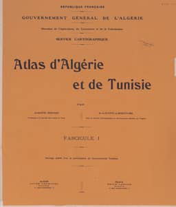
Atlas of Algeria and Tunisia. Fascicle I: Geology
Algeria · 1925
Atlas of Algeria and Tunisia. Fascicle V: Climatology: Mean Annual Rainfall
Algeria · 1926
Atlas of Algeria and Tunisia. Fascicle VII: Climatology
Algeria · 1928
Atlas of Algeria and Tunisia. Fascicle VIII: Rural Housing of the Indigenous Population
Algeria · 1929
Atlas of Algeria and Tunisia. Fascicle IV: Vegetation
Algeria · 1925
Comments
Loading...
0/2000