
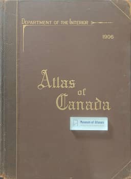
The atlas of Canada
L'atlas Du Canada
- Publication
- Annales de Géographie
- Volume
- 17
- Issue
- 94
- Pages
- 360-363
Canada · Version 1
1906–1915H. Baulig reviews the Atlas of Canada, which grew out of the census and extends its coverage to the Dominion's principal geographical features. He describes its census tables, 46 map plates and statistical diagrams updated where possible. The maps cover physical geography, communications, climate, population, ethnic origins, boundaries, exploration and cities. Baulig praises the use of matching scales and colour gradations across eastern and western provinces, which facilitates comparison, and singles out the map showing the limits of 42 tree species. He notes that the geological map largely reproduces the 1882 Dominion map, with western revisions drawn from the 1901 edition. His reservations include the failure to distinguish poorly explored areas, potentially misleading geological colouring and somewhat arbitrary railway service territories. He concludes that bringing distribution patterns together suggests hypotheses about their interdependence and judges that the Canadian government and Mr White succeeded in making their country better known.
Related Atlases
Comments
Loading...
0/2000