
Reading chronicle: Atlas of East Timor; Timor Lorosa'e, a country at the crossroads of Asia and the Pacific
La chronique des lectures: Atlas de Timor Leste; Timor lorosa'e, pays au carrefour de l'asie et du pacifique
- Publication
- Lusotopie
- Volume
- 10
- Pages
- 511-512
Timor-Leste · Version 1
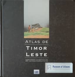
2002The reviewer describes GERTIL's 2002 Atlas de Timor Leste as a Portuguese-language team publication with nine chapters and about 45 topics, generally mapped at 1:1,200,000, plus six topographic sheets at 1:250,000 covering the country. Its coverage includes history and culture, the natural environment, administration, population and settlement, economic activity, international trade, and development indicators. The reviewer finds the information surprisingly rich for a country emerging from prolonged violence, while noting uneven precision that reflects heterogeneous available data. Criticisms include pictograms without size variation, unnumbered maps, and errors in precipitation and bathymetric units. Developed commentaries, graphs, abundant high-quality colour photographs, and monochrome drawings of Timorese traditions receive praise. The reviewer considers the atlas complementary to Frédéric Durand's geohistorical atlas.
View whole-article summary
This is a review of two atlases on East Timor. The reviewer notes that 2002, the year of East Timor's independence, also saw the nearly simultaneous publication of two important atlases: one produced by the Gertil group at the Technical University of Lisbon in Portuguese, and the other by geographer Frédéric Durand in French. The review details the structure and features of both works. The Portuguese atlas covers nine chapters including history, culture, nature, administration, demography, economy, and development indicators, offering rich information despite some technical flaws. The French atlas focuses on the period from the end of Portuguese occupation to the eve of independence, with detailed analysis of Indonesian military operations and resistance, though its organization is somewhat fragmented. The reviewer concludes that the two atlases are complementary rather than competitive, and represent the best current references for understanding this young Southeast Asian state.
Comments
Loading...
0/2000