
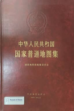
Inheritance and Development, Innovation Through Renewal: Celebrating the Publication of the National General Atlas of the People's Republic of China
继承发展,推陈创新:祝贺《中华人民共和国国家普通地图集》出版
- Publication
- 地图
- Issue
- 2
- Pages
- 58-60
China · Version 6
1989–2012Liao Ke welcomes the publication of the National General Atlas of the People’s Republic of China, the first volume of the national atlas series. He traces the programme’s inclusion in the 1956 national science plan, the start of general-atlas work in 1959, its interruption during the Cultural Revolution, and the 1981 approval to resume compilation within a five-volume series. Guided by Zeng Shiying and led and edited by Yu Cang, the atlas was produced by more than a hundred cartographers organized by three institutions. Liao describes its preparation through earlier Chinese atlas experience, domestic and foreign examples, overall planning and cartographic experiments. His review emphasizes three strengths: systematic coverage, detailed and current information, and innovative design. Provincial maps form the core, complemented by national thematic, regional, sea-area, selected-area and city maps; city maps include land use. Compilation used recent surveys, 1:1,000,000 topographic maps and some satellite imagery, with updates through the end of 1991. Place names drew on the national survey and local-government review, supported by a database-based index. Design innovations include regional relief shading, separate sea-area maps depicting seabed relief, revised plateau colours, and elevation tints adjusted to China’s three terrain steps. Liao praises the atlas’s production quality and international standard and anticipates its use in planning, defence, research and education.
Related Atlases
Comments
Loading...
0/2000