
Development, contents and design of the revised edition of the National Resources Atlas of Thailand
- Publication
- Eighth United Nations Regional Cartographic Conference for Asia and the Far East. Volume 2: Technical Papers
- Pages
- 247–250
Thailand · Version 1
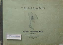
1966–1968The Thai account states that the Royal Thai Survey Department, working with other government departments, updated and revised its 1964 thematic map set and published it in two volumes in 1966 and 1968, the first to bear the title National Resources Atlas of Thailand. Folding the 1:2,500,000 maps reduced the format to 39.5 × 28.2 cm and allowed the inclusion of 94 text pages. The account notes that this compact format made the maps difficult to use.
View whole-article summary
This paper reviews thematic mapping by the Royal Thai Survey Department since 1961 and the successive editions of the National Resources Atlas of Thailand, then describes the fourth-edition revision begun in 1974. Political and economic constraints led the department to undertake a major revision of the resources atlas, under the short series title Atlas of Thailand, as a possible foundation for a future national atlas. Organized into natural, human, and economic resources, the revision expands thematic coverage and emphasizes relationships and comparability among maps. Most maps use two standardized bases at 1:2,500,000 and 1:4,000,000 on a newly calculated equal-area projection, supplemented by varied cartographic symbols, statistical graphics, cross-sections, drawings, and bilingual Thai–English labeling. Explanatory text pages are initially omitted because sufficient expert assistance is unavailable. A boxed loose-leaf format permits individual use, replacement, and subsequent additions. At the time of reporting, most drafts for the first 60 map pages were complete and undergoing reproduction processing; several maps had already been published.
Related Atlases



Comments
Loading...
0/2000