
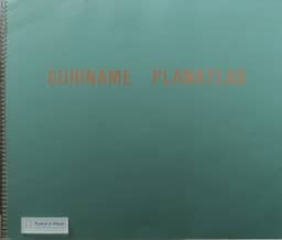
Book reviews: Saint Lucia Planning Atlas; Suriname Planatlas
- Publication
- European Review of Latin American and Caribbean Studies
- Issue
- 50
- Pages
- 181-183
Saint Lucia · Version 1
1987A joint review of two Organization of American States atlases in which the Saint Lucia Planning Atlas (1987) is judged "by far the weaker of the two." Gary Brana-Shute describes a 47-page booklet introducing six multi-color maps, each 27 x 44 inches and foldable into a cardboard jacket the size of a standard textbook, drawn with the assistance of the St. Lucia Ministry of Agriculture, Lands, Fisheries, Co-Operatives and Labour. The maps use transverse Mercator projection at 1:50,000 and are easy to read, with straightforward, informative legends. The booklet, however, offers no bibliography and no narrative or analytical discussion of the island and its population, which the reviewer says diminishes the value of the plates; a reader who starts with little knowledge of St. Lucia may get no more than "a colorful melange." Topical sheets cover geology, rainfall and drainage, life zones, land capability, land use and vegetation, and land distribution and tenure, each marking major settlements, roadways, district boundaries and sites such as airports and industrial parks.
View whole-article summary
This review examines the Saint Lucia Planning Atlas (1987) and the Suriname Planatlas (1988), both published by the Organization of American States' Department of Regional Planning. The author notes that these atlases aim to map natural and human resources to support development planning in Caribbean nations. While the Saint Lucia atlas features visually appealing maps, its accompanying booklet lacks narrative and analytical content, limiting its utility. In contrast, the Suriname atlas integrates maps with explanatory texts in Dutch and English, offering historical background, statistical data, and thematic coverage, making it more valuable for social scientists. The review underscores the importance of such spatial references in understanding the cultural, social, and historical configurations shaped by ecological and physical endowments.
Related Atlases
Comments
Loading...
0/2000