
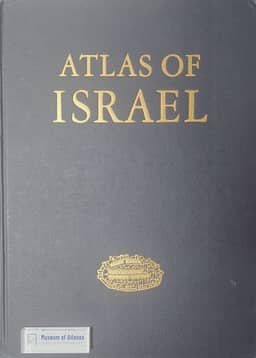
Reviews: Atlas of Israel
Anmeldelser: Atlas of Israel
- Publication
- Geografisk Tidsskrift
- Volume
- 69
- Issue
- 2
- Pages
- 204-206
Israel · Version 1
1956–1970Niels Nielsen reviews Atlas of Israel: Cartography, Physical Geography, Human and Economic Geography, History, published by the Survey of Israel and Elsevier in 1970, with approximately 550 maps and extensive commentary. Its thematic coverage extends to the ceasefire lines with Syria and Jordan and includes Gaza but excludes Sinai, roughly matching the 1920 Palestine Mandate. Nielsen considers this scope geographically useful while noting uneven statistics and potential political objections. He outlines the atlas's account of cartographic development, from the Medeba mosaic through Jacotin and British surveys to mapping continued and completed by the Survey of Israel, and praises its technical resources and qualified contributors, particularly David Amiran. Freshwater supply receives special attention within its broad physical-geographical coverage; short observation series and uncertain effects of interventions limit assessment of the water system. Nielsen also discusses the atlas's treatment of nearly two million Jewish immigrants, their differing backgrounds, and changes in settlement, irrigated agriculture, urbanization, industry, transport and social conditions, alongside political conflict and successive wars. He values its consolidated account of these changes and reads them in the context of Ottoman rule, the British Mandate, the formation of Israel, and international interests in oil and the Suez Canal.
Related Atlases
Comments
Loading...
0/2000