
Reviews: Atlas of the Republic of Austria
Anmeldelser: Atlas der Republik Österreich
- Publication
- Geografisk Tidsskrift
- Volume
- 61
- Pages
- 143-144
Summary
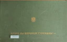
This review assesses the first installment of Atlas der Republik Österreich, published in Vienna in 1961. The Austrian Academy of Sciences’ spatial research commission, led by Hans Bobek and supported by a large team, had produced the first maps. The atlas was planned in twelve thematic groups, with 85 principal maps at 1:1,000,000, 140 smaller-scale maps, and additional diagrams and city maps. The reviewer praises the installment’s careful technical execution, especially the detailed settlement-type map of Vienna and the clear depiction of land use. Read alongside maps of cereals and root crops, the land-use map shows contrasts between Alpine grasslands and lowland arable farming. The 1957–58 bus-traffic map distinguishes eastern and southeastern networks centered on Vienna, Graz, and Klagenfurt from northwestern networks around Linz, Salzburg, and Innsbruck. Maps of tourist visits in 1956–57 and Catholic administrative organization also receive attention. The reviewer concludes that the installment promises an atlas of high quality.
Comments
Loading...
0/2000