
Note on French tropical cartography in Africa
- Publication
- United Nations Regional Cartographic Conference for Africa, 1–12 July 1963, Nairobi, Kenya. Vol. 2: Proceedings of the Conference and Technical Papers
- Pages
- 66–69
Summary
This survey reviews postwar French topographical mapping, thematic cartography, and atlas compilation in North, West, and Central Africa and Madagascar. Joly identifies topographical maps as the basis for thematic mapping and judges that mapping of the natural environment has generally advanced further and on a larger scale than mapping of human geography. He surveys geological, soil, vegetation, population, agricultural, and economic maps, then discusses atlases of Algeria and Tunisia, Morocco, and Cameroun, distinguishing published material from planned additions. He considers earlier atlases useful in some respects but partly outdated, and identifies Morocco as the principal area of postwar progress in atlas publication. For newly independent states, he recommends parallel efforts: gradual production of basic national atlases supported by fieldwork and aerial photography, alongside more rapidly compiled, manageable small-scale atlases drawing on existing documentation.
Related Atlases
Atlas of Algeria and Tunisia. Fascicle II: Hypsometry
Algeria · 1924
Atlas of Algeria and Tunisia. Fascicle III: Climatology: Temperatures
Algeria · 1924
Atlas of Algeria and Tunisia. Fascicle VI: Climatology: Mean Monthly Rainfall
Algeria · 1927
Atlas of Algeria and Tunisia. Fascicle IX: Demography
Algeria · 1929
Atlas of Algeria and Tunisia. Fascicle XIII: Indigenous Populations
Algeria · 1933
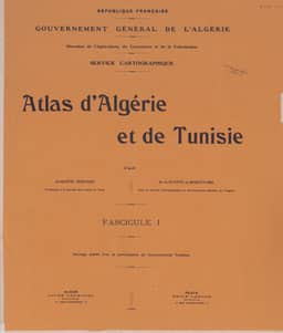
Atlas of Algeria and Tunisia. Fascicle I: Geology
Algeria · 1925
Atlas of Algeria and Tunisia. Fascicle V: Climatology: Mean Annual Rainfall
Algeria · 1926
Atlas of Algeria and Tunisia. Fascicle X: Demographic Maps
Algeria · 1932
Atlas of Algeria and Tunisia. Fascicle XIV: Map of Official Colonization
Algeria · 1934
Atlas of Algeria and Tunisia. Fascicle VII: Climatology
Algeria · 1928
Atlas of Algeria and Tunisia. Fascicle XII: Agricultural Map
Algeria · 1933
Atlas of Algeria and Tunisia. Fascicle VIII: Rural Housing of the Indigenous Population
Algeria · 1929
Atlas of Algeria and Tunisia. Fascicle XI: Forest Maps
Algeria · 1932
Atlas of Algeria and Tunisia. Fascicle IV: Vegetation
Algeria · 1925
Atlas of Algeria and Tunisia. Fascicle XV: Agricultural Maps
Algeria · 1935
Comments
Loading...
0/2000