
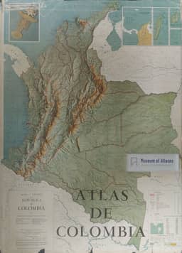
Register of thematic maps: Atlas of Colombia
Registro de mapas temáticos: Atlas de Colômbia
- Publication
- Revista Geográfica
- Issue
- 68
- Pages
- 191-192
Summary
Bertha K. Becker reviews the Atlas de Colombia, published in October 1967 by the Instituto Geográfico Augustin Codazzi with contributions from public and private organizations. Its 203 pages contain about 150 maps, diagrams, and plans, alongside photographs and drawings. Becker credits the substantial compilation and systematization of existing cartographic studies, while noting marked differences in cartographic quality, information, and graphic conventions. A geographical overview and bibliography precede 37 sections covering educational topics, historical cartography, national geography, and territorial units with city plans. Becker particularly praises the number, organization, and information content of the physical-geography maps. She finds the human and economic maps weaker in form and content: apart from maps of population, living standards, and Guhl’s geo-economic regions and centers of attraction, they largely show distributions of products and crops without explaining spatial relationships. She interprets these contrasts as reflecting Colombia’s economic development and the weight of natural conditions in human organization, and sees the atlas as a transition from descriptive, enumerative cartography to dynamic, interpretive cartography.
Comments
Loading...
0/2000