
Geographical atlas of Colombia
Географический атлас Колумбии
- Publication
- Известия Академии наук СССР. Серия географическая
- Issue
- 5
- Pages
- 110–117
Summary
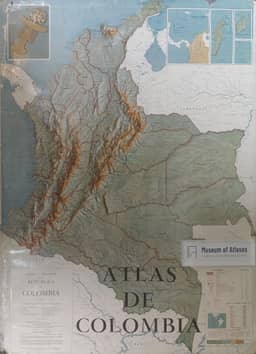
S. V. Zonn, R. S. Narskikh and N. A. Timofeeva review the 1969 second edition of Atlas de Colombia, published by the Agustín Codazzi Geographic Institute, within the expansion of Latin American national atlases concerned with resource inventories and evaluation. Several Colombian institutions participated, two banks financed publication, and the compilers consulted International Geographical Union recommendations. The atlas contains a geographical description, 169 maps including 23 city plans, extensive illustrations and an index of about 5,200 names. Its coverage extends from astronomy and historical cartography to physical geography, population, culture, economic activity, transport and departmental maps. The reviewers describe compilation sources, including climate and population maps borrowed from Atlas de economía colombiana, a soil map based on FAO mapping, and an ecological map generalized from the institute’s 1962 map. They highlight historical facsimiles, the Chibcha settlement map, climatic mapping and the depiction of population concentration in the Andes and Caribbean coastal region. They also identify uneven scientific coverage: geomorphological and runoff maps are absent, soils are schematic, and several environmental maps have inconsistent boundaries. Population growth and urbanization are omitted, migration symbols are insufficiently explained, and cultural and health maps provide incomplete accounts of services. Economic maps show mineral resources, petroleum concessions, industry and agriculture, but omit land tenure, land use and agrarian reform; pictorial industrial symbols obscure actual locations, and economic regionalization lacks an explanation. Transport maps include road-traffic intensity, but omit ownership, major freight flows, port hinterlands and port throughput. The reviewers also criticize schematic relief, missing trade and finance themes, and editorial errors. The second edition adds astronautics and photographs, improves coloring without changing map content, and updates some statistics to 1966–1967. Despite these limitations, the reviewers praise its accessible account of Colombia and the educational and scientific value of its illustrations, design and production.
Comments
Loading...
0/2000