
Concept, Design and Production of the new "Atlas of Thailand"
- Publication
- GeoJournal
- Volume
- 4
- Issue
- 1
- Pages
- 76-79
Summary
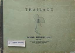
Freitag describes the Royal Thai Survey Department’s compilation of the new Atlas of Thailand as the revised fourth edition of the National Resources Atlas of Thailand, placing it within the development of national atlases and IGU guidance. He traces the department’s work from unwieldy 1:1,000,000 maps in 1961 through the folded volumes of 1966 and 1968, the 1969 edition with 17 maps organized into three sections, and the 1972 edition with 19 maps, bilingual text, a uniform hypsometric base and improved graphics. The new revision began in 1974; by 1976 all but two map drafts were complete and 29 map pages had been printed, but limited reproduction and printing capacity delayed publication. Its planned coverage comprises natural, human and economic resources, principally at 1:2,500,000 and 1:4,000,000. Freitag explains the folded-page design, modified because suitable heavy paper was unavailable, and a new Albers equal-area topographic base generalized from survey maps and supplemented by nautical charts and road maps. Compilation involved adjusting other agencies’ maps to this base, adding datasets, and producing maps from statistics, field surveys, aerial photographs and Landsat imagery. Examples include relief-adjusted climatic isarithms and a population-distribution map combining 1970 census figures with village locations, which he calls Thailand’s first detailed map of this kind. Profiles, drawings and diagrams supplement the maps. The department’s first attempt at four-colour printing produced discrepancies between intended and printed colours; despite these, Freitag judges the atlas a valuable information and research tool for its accurate, contextual coverage.
Related Atlases



Comments
Loading...
0/2000