
Book reviews: National Atlas of Afghanistan
- Publication
- Erdkunde
- Volume
- 69
- Issue
- 1
- Pages
- 87-88
Summary
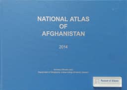
Jörg Stadelbauer reviews Andreas Dittmann’s National Atlas of Afghanistan (2014), produced through longstanding German–Afghan cooperation involving Kabul University, the Afghan Agency for Geodesy and Cartography, and Gießen University. Maps and accompanying explanations cover the natural environment, socio-economic conditions, and six major cities. Compilation involved reviewing and standardizing existing studies and maps, tracing dispersed data and research literature, and conducting field surveys for the city overviews. Stadelbauer highlights distribution maps for 83 animal species. Socio-economic maps occupy about two-thirds of the atlas and raise greater concerns about data availability and reliability: informal trade is difficult to quantify, agricultural statistics require regional data collection, and maps of public services offer limited qualitative information. Satellite imagery can supply some agricultural data. The reviewer notes unequal healthcare provision and women’s educational disadvantage, alongside gaps in coverage of industry, crafts as economic activities, and history. He also identifies missing reference years and minor editorial shortcomings, while praising the layout and cartographic design as a benchmark. He regards the atlas as a foundation for comprehensive, spatially differentiated regional geography and an aid to planning. Particularly if a Dari edition follows the English edition, he argues that it could strengthen national self-confidence, identity, governance, and nation-building.
Comments
Loading...
0/2000