
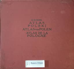
Geographical and statistical atlas of Poland
Atlas geograficzno-statystyczny Polski
- Publication
- Anzeiger der Akademie der Wissenschaften in Krakau, Philologische Klasse, Historisch-Philosophische Klasse
- Issue
- 8-10
- Pages
- 168-177
Summary
Eugeniusz Romer describes the compilation and ongoing publication of the Geographical-Statistical Atlas of Poland, presenting the first installment in proof. He connects the project to Poland’s political partition and his wish to show its former unity, the effects of differing administrations and its collective importance. With financial support secured through Fr. Stefczyk and Polish savings and loan associations, the manuscript contains 65 maps on 32 plates with accompanying texts, intended for publication in three installments. Its four sections cover physical geography and political history; nationality, religion and culture; social conditions, soils, agriculture and livestock; and mining, industry, transport and cooperative credit. Coverage centers on Poland’s 1772 territory and includes additional provinces relevant to the Polish population. Romer recounts collecting sources from libraries, statistical offices and private collections, with specialist collaborators contributing individual subjects. Incompatible Russian, Prussian and Austrian statistics required extensive recalculation: industrial production values were converted into worker counts, and large-industry employment into estimates of the industrially active population. He acknowledges assumptions and estimates an average error of about 10%, reaching at most 25%; incomplete school and livestock data and incompatible railway statistics also restricted coverage. Interpolation produced lines of equal statistical value, termed isarithms using a name supplied by J. Mesk. Romer argues that these clarify human-geographical relationships, while acknowledging departures from exact interpolation. He details the first installment’s historical, administrative, demographic, religious, educational and cultural maps and the explanatory texts documenting sources, procedures and interpretation. He presents the atlas as material for examining partition-era differences, assessing wartime losses and reconstructing historical routes of material and intellectual culture.
Comments
Loading...
0/2000